Project Categories

Home    Projects   Civil/Structural/Port & Harbor Engineering    Seawalls, Revetments, Dikes & Levees

Seawalls, Revetments, Dikes & Levees

Stone & Concrete Armor Block Seawalls & Revetments, and Earthen Dikes & Levees with/or without Armor Protection

Listed below are many of the projects we’ve completed for our clients over the years. We’ve chosen to focus and expand on several key examples which are highlighted in blue. Clicking on those projects allows you to view in-depth what services NCI provided as well as details on the project itself.

Hamilton Wetlands Restoration Project

Novato, CA

NCI is the prime A/E contractor for a series of jobs for the San Francisco District Corps of Engineers on the Hamilton Wetland Restoration Project. This is a project to convert over 500 acres of a decommissioned army airfield to a wetland restoration area using dredged spoil material. The area will consist of seasonal and tidal wetlands. NCI has worked, or is working on 4 separate deliver orders under 2 separate IDIQ contracts.


These consist of:


1. Topographic mapping of the site using aerial photography, bathymetric surveys and land surveying to be used for planning, design and preparation of contract documents for design of all project features.

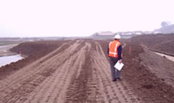
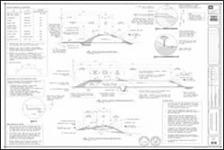
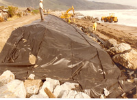
2. Land surveying, geotechnical review, design, cost estimating and preparation of contract documents for the Bulge Levee and the Pacheco Pond Levee. These levees perform containment for a portion of the seasonal wetland. Design features included a ramp over the levee for construction and future access, tying into the existing Pacheco Pond Levee, using onsite borrow material, drainage, a road base, and demolition of existing facilities. MCACES was used to prepare the cost estimate. SPECSINTACT was used to develop the specifications. A SWPPP was prepared for the project.

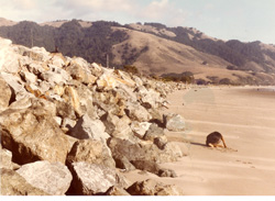
3. Additional design and preparation of contract documents for the N-1 Levee and Containment Berm to complete the perimeter of the seasonal wetland. Similar design services were provided for the Bulge Levee. Critical design issues included minimizing potential impact to an adjacent forced main sanitary sewer line. Both the Bulge Levee and N-1 Levee delivery orders were completed on an expedited schedule.

4. Bathymetric surveying and numerical modeling to evaluate the effectiveness of and impacts from the wetland restoration project. This involved numerical simulations of hydrodynamics and sedimentation in the project area that includes both Novato Creek and the to-be-restored wetlands.


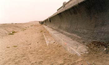
NCI is currently under contract with the Corps of Engineers (San Francisco District) to perform on-call design services for navigation and water resources projects. The largest design project to date is for the Hamilton Wetlands Restoration Project, which will be used as an upland dredged material disposal site until the restoration goals are achieved. This project involved the mapping (aerial topography, land surveying, and hydrographic surveying) of the site and surrounding areas and the detailed design and preparation of construction documents for two levees (3,240 feet long) to contain pumped-in dredged material. The owner is the California Coastal Conservancy, however the work was performed under contract to the San Francisco District Corps of Engineers. The work included evaluating potential onsite borrow areas, demolition of a hydraulic siphon system, design of a culvert through the levee for storm water flow, design of an access ramp over the levee suitable for construction equipment, connection to an existing levee, design of the levee cross-section to maintain clearance to the property line for a maintenance road and to provide a varying slope for aesthetics, and design of an aggregate base road surface. Quantity computations were performed, a SWPPP was prepared, SPECSINTACT was used to prepare contract specifications, and MCACES was used to prepare the engineer’s cost estimate. The design project was completed under an expedited time schedule.


Hamilton Wetlands Restoration Project Hamilton Wetlands Restoration Project

Broad Beach Seawall Repair

Malibu, CA

In 1997 a 160 feet long seawall was constructed in front of four properties at the western end of Broad Beach, Malibu in order to protect these homes during periods of high storm waves occurring during extreme high tides and severe beach erosion. The seawall consists of drilled in-place steel pipe piles extending into hard bedrock that supports epoxy coated steel sheet piles driven into an upper silty-clay formation that underlies the beach sand deposits. In addition, a reinforced concrete cap covers the upper portion of the steel sheet piles down to the top of the steel pipe piles. NCI has performed routine inspection of this seawall over the years, and during that time has observed the gradual increase in corrosion to the steel structural components of this seawall. In 2008 NCI prepared a detailed report addressing the application of potential protective coatings for the maintenance of this seawall.


Then after the occurrence of high storm waves during extreme high tides and beach erosion in January 2010, NCI recommended the urgent need in proceeding with the necessary repairs to this seawall. After the preparation of the construction repair plans, specifications and contract documents, and in securing all necessary regulatory permits, the construction repairs consisted of removing all steel corrosion, applying an externally bonded fiber reinforced polymer strengthening system, extending the seawall return walls further landward, performing epoxy injection and mortar repairs to the concrete, and improving drainage and backfill on the seawall’s landward side. Repair work was completed in July 2010.


Broad Beach Seawall Repair Broad Beach Seawall Repair

Seadrift Revetment Shoreline Protection, Original Construction & Subsequent Repairs

Stinson Beach, CA

During the midst of the 1983 storm waves, NCI provided emergency engineering design, plans and full-time construction inspection for the placement of over 35,000 tons of rock riprap along 7,500 lineal feet of shoreline for the protection of 125 property owners and residences. Close cooperation between NCI, the client and the contractor prevented the loss of any residence. This structure was constructed to a 2.5:1 (horizontal: vertical) slope with a toe elevation of approximately +7 feet MLLW (Mean Lower Low Water) and a crest elevation of +17.5 feet MLLW. Prior to 1983, an emergency revetment structure was constructed during the winter season of 1978 along the western portion of the existing structure and in 1980 along the eastern portion. This emergency structure on the eastern portion consisted of first installing sand-filled geotextile Longard tubes and then placing stone directly behind the Longard tubes.


Since the emergency placement of this revetment in 1983, NCI has provided ongoing beach monitoring surveys and inspection of the revetment to assess beach impacts, as well as services for final regulatory permit acceptance. Additionally, during 1998, NCI performed a detailed inspection/evaluation of the entire seawall structure, and based on this evaluation, recommended the placement of 5,500 tons of new stone on a lot-by-lot basis for stone that had settled/dislodged during the previous 15 years. NCI then prepared the construction contract documents, secured regulatory agency approvals, performed contractor bidding and award/negotiation of contract, and provided full time resident inspection and construction management during placement of this additional stone. Also, in 2004 and 2006 NCI again provided the same services for the placement of 3,000 tons of new stone during 2004 and the placement of 700 tons of new stone repair work during 2006. Since 1985, NCI has continued to provide either annual or bi-annual inspections/evaluations and to recommend additional repair work as necessary.


Seadrift Revetment Shoreline Protection, Original Construction & Subsequent Repairs Seadrift Revetment Shoreline Protection, Original Construction & Subsequent Repairs

Ocean Beach Shoreline Protection Great Highway Seawall

Ocean Beach, CA

NCI performed a comprehensive oceanographic investigation for 6,000 lineal feet of Ocean Beach, and provided planning and engineering services for the design of a major shoreline protection structure. Analysis included wave forecasting, littoral sediment transport, design water levels, beach erosion and sand replenishment. Alternative structural seawall configurations for various beach reaches were proposed, and then a physical hydraulic model investigation of these alternatives was performed by NCI to select a final seawall configuration and to finalize the engineering design criteria. The designed seawall was a modified O’ Shaughnessy structure consisting of a reinforced concrete upper section and stepped lower section, supported by concrete piles, and included cut-off piles at the structure’s toe. NCI also provided construction quantity take-offs and cost estimates. A beach monitoring and sand re-nourishment plan was developed to ensure that a minimum beach width is maintained.


NCI also provided coastal engineering peer review to the National Park Service for temporary shoreline protection prepared by the City of San Francisco for the eroding shoreline south of Sloat Blvd. The City of San Francisco had prepared plans to protect facilities south of Sloat Blvd. due to accelerated shoreline erosion. NCI reviewed available data and reports, and alternatives prepared by the City, and recommended modifications to the alternatives. Specifically, we evaluated alternative toe and crest elevation, armor rock and bedding layer size, structure slope, alignment, location and revetment length, and revetment flanks. Dune nourishment was also evaluated and a report of our peer review was submitted.


In addition, NCI analyzed and recommended procedures for placing sand on the beach that was excavated from the Oceanside Treatment Plant and the Lake Merced Transport System. The work involved the analysis of historical beach cross-sections, recommendation on proposed placement sections, and periodic construction observation. An analysis of beach nourishment was also performed as a potential shoreline protection method along Ocean Beach. This study was a result of comments and questions from the National Park Service and California Coastal Commission on the City plans for a seawall. Analysis included an evaluation of historical beach cross-sections, analysis of available sand sources generated from the Westside Transport System construction, and an analysis and costs of alternative sand sources.


Ocean Beach Shoreline Protection Great Highway Seawall Ocean Beach Shoreline Protection Great Highway Seawall
© 2024 Noble Consultants, Inc.