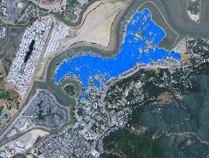
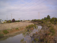
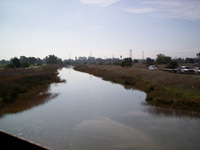
Las Gallinas Creek H & H Coastal Analysis
Marin County, CA
NCI performed and analysis to develop the riverine and coastal floodplain maps for the without project existing (year 0) condition and the without project future (year 50) condition. The performance of the flood control project was also evaluated using the risk and uncertainty method.
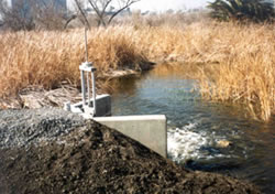
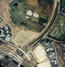
The tasks performed for the H&H analysis included: collecting and reviewing the hydrological and hydraulic data, tidal stages, and topographic/bathymetric data; developing a Digital Elevation Model (DEM) by merging the channel cross section survey and the levee profile survey into the County’s DEM; developing a HEC-RAS model for the South Fork of Las Gallinas Creek and adjacent floodplains, with the geometric data being derived using HEC-GeoRAS; conducting riverine hydraulic modeling and floodplain delineation using the HEC-RAS and HEC-GeoRAS models, and developing riverine floodplain maps for eight flood events for both the year 0 and the year 50 conditions; estimating uncertainties in water surface elevations considering the uncertainties in HEC-RAS model parameters; computing the conditional non-exceedance probabilities for the 100-year flood event; and evaluating the project performance based on the freeboard requirements for the 90% or 95% probability of non-exceedance.
The tasks performed for the coastal analysis included: conducting tidal statistic analysis, and deriving tidal frequency curve for the project site; estimating sea level rise based on the historic trend and on the USACE guidance (EC 1165-2-211), and developing the resulting tidal frequency curve in year 50; conducting wave hindcasting and determining return wave conditions in San Pablo Bay; determining wave conditions at the project site by transforming waves from the Bay to the site and by including the local wind waves generated within the marshland; computing wave runup, wave overtopping rate and cumulative water volume for eight coastal storm events considering the difference in levee characteristics; and determining the coastal inundation water levels, and developing the coastal inundation floodplain maps for eight coastal storm events for both the year 0 and the year 50 conditions.