Project Categories

Home    Projects   Coastal Engineering    Other

Other

Other coastal analyses such as wetlands restoration, dredging, impact analysis, etc.

Listed below are many of the projects we’ve completed for our clients over the years. We’ve chosen to focus and expand on several key examples which are highlighted in blue. Clicking on those projects allows you to view in-depth what services NCI provided as well as details on the project itself.

Golden Gate Fields Pier & Shoreline Improvements

Albany, CA

NCI performed coastal engineering analyses to develop a suite of waterfront improvement concepts at Golden Gate Fields in Albany, CA. This project was part of a larger mixed use development proposed for the site. The waterfront improvement concepts included the restoration of a dilapidated pier to increase bay access and to expand the existing beach by extending it into the paved parking to the south.


Our work consisted of a site reconnaissance that included surveying cross sections at the historic pier location and along the existing beach; analyzing historic wind data to determine predominant storm wind directions; and analyzing expected stable beach profiles.


Concept components that were evaluated included a pile supported pier, a rubble mound groin to provide beach stability, beach nourishment, and a buried revetment to provide ultimate shoreline protection if storm induced erosion threatened improvements.


Golden Gate Fields Pier & Shoreline Improvements

BEACON Coastal Regional Sediment Management Plan

Ventura and Santa Barbara Counties, CA

Regional Sediment Management (RSM) is a planning approach that seeks to address coastal sediment processes on a broader geographic scale. It recognizes that sand, cobble, and fine sediment are important natural resources that are critical to the environmental health and economic vitality of the coastal zone. The relevant sediment processes overlap multiple geopolitical boundaries which explains why a regional planning perspective is needed.


California has been actively engaged in finding ways and means to resolve coastal erosion and sediment management issues on a broader scale. The State Resources Agency and its member Departments have joined together with the US Army Corps of Engineers and other advisory groups to form the Coastal Sediment Management Workgroup (CSMW). The CSMW intends to fulfill regional sediment management objectives by developing a series of regional Plans that are geographically specific to and target the distinct shoreline segments of the California coast.


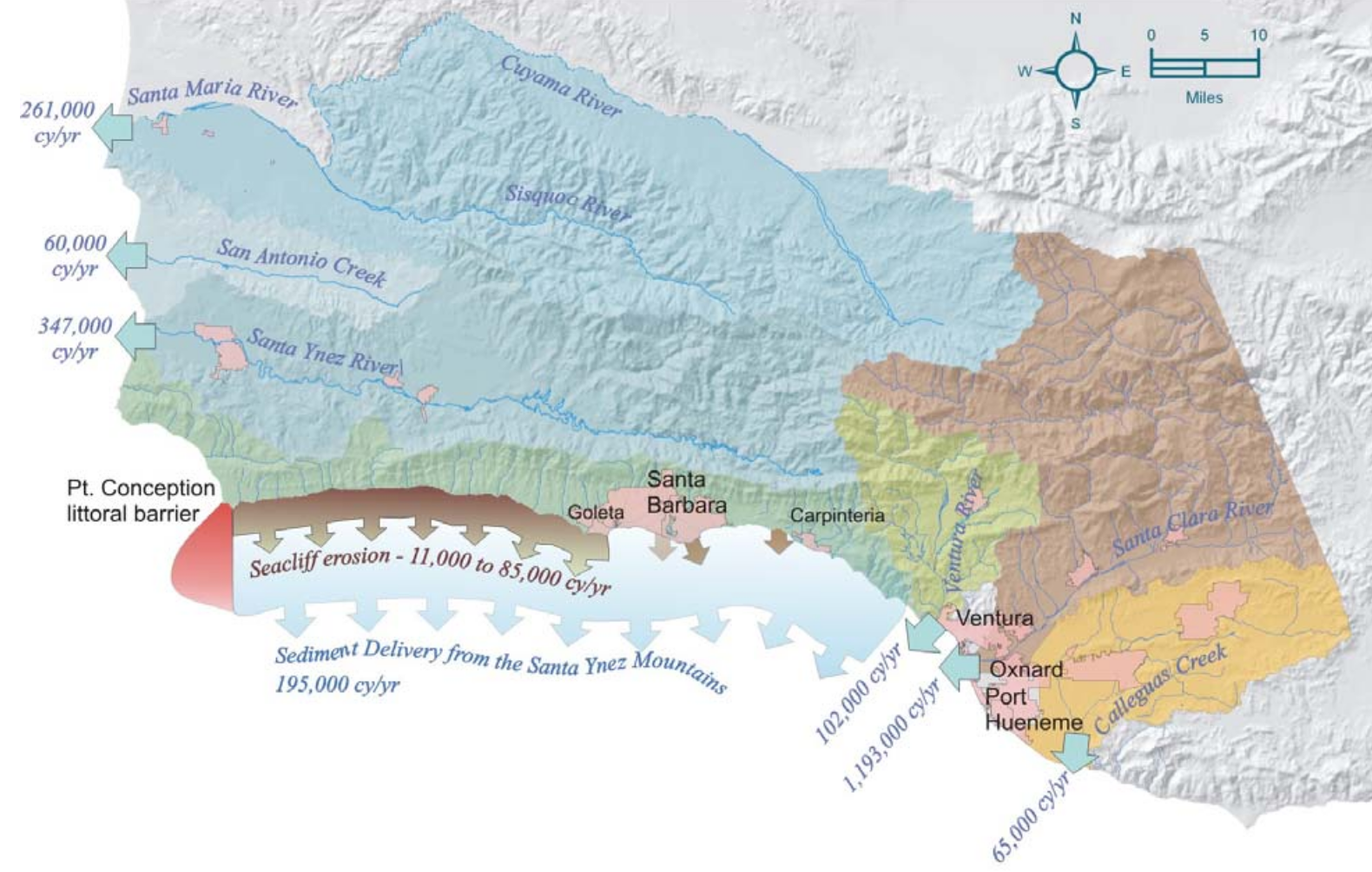
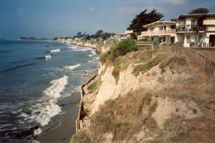
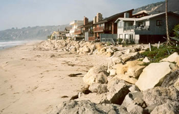
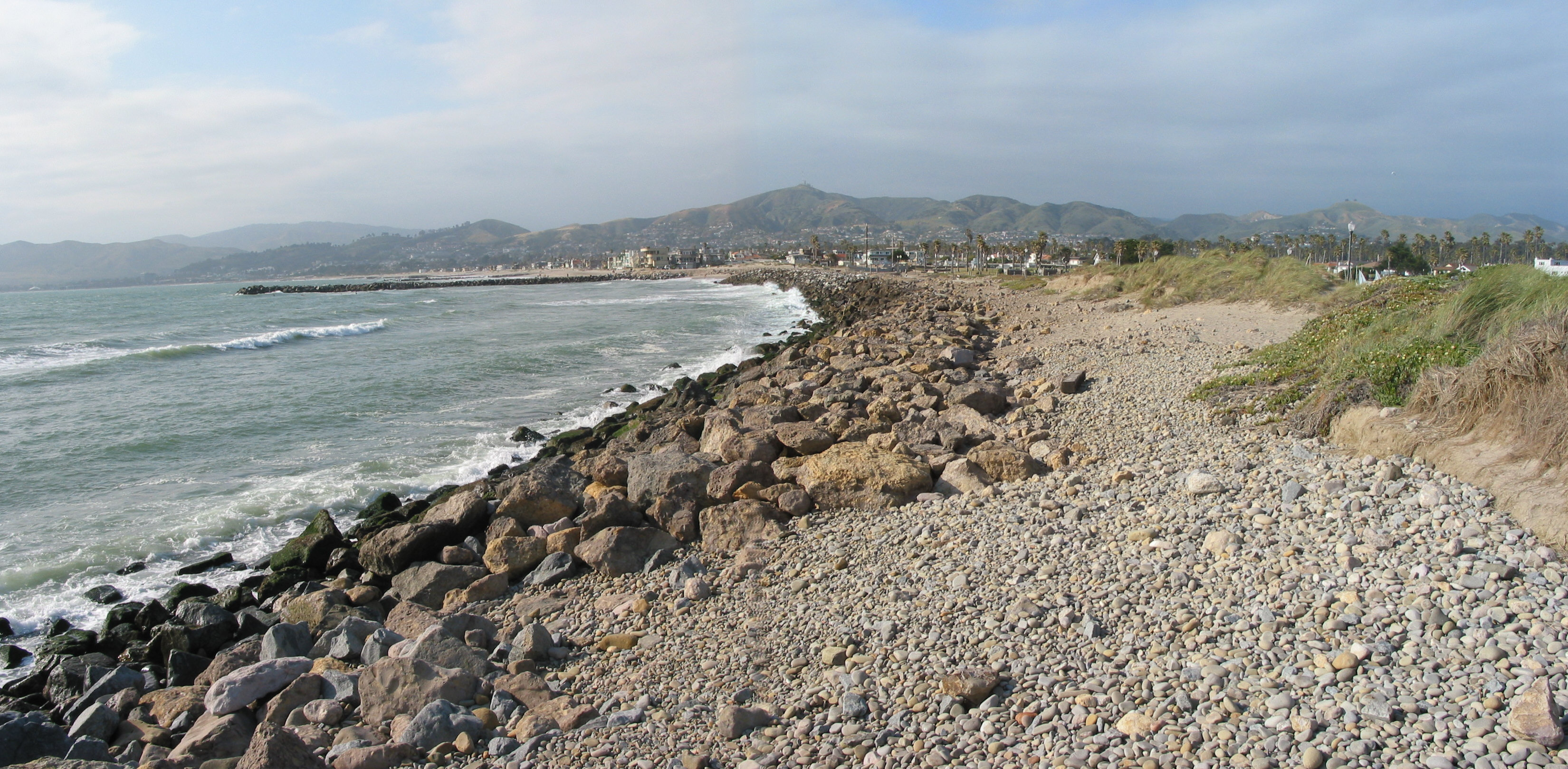
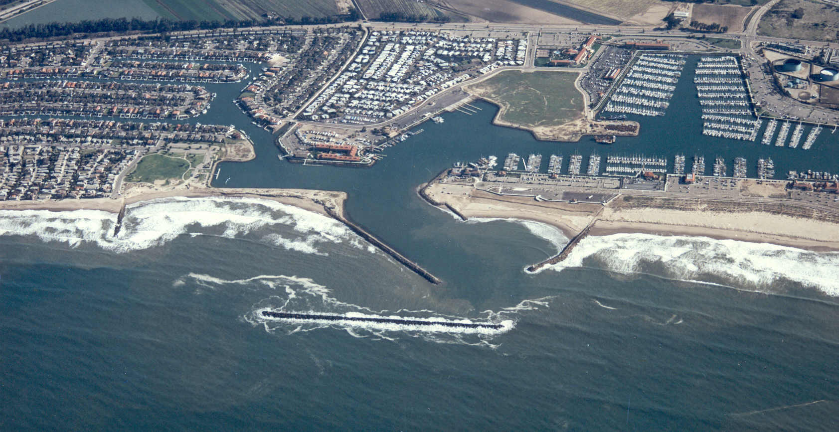
The coastal regional sediment management plan (CRSMP) that was developed for the 144-mile long Santa Barbara Littoral Cell required consideration of a diverse coast that varies in shoreline orientation, physical characteristics, land use, and population density. The Plan’s goals and objectives included development of a comprehensive road map to addresses how to conserve and restore the valuable sediment resources, reduce shoreline erosion and coastal storm damages, protect sensitive environmental resources, increase natural sediment supply to the coast, preserve and enhance beaches, improve water quality along the shoreline, and optimize the beneficial use of material dredged from ports, harbors, and other opportunistic sediment sources.


The Plan was developed systematically using traditional planning processes to understand the baseline science and relevant physical processes; identify the challenges that currently exist and the corresponding opportunities that can be seized to positively move forward; and formulate appropriate action plans and solutions that have unanimity of purpose. The adopted Plan consists of a suite of equally diverse study, management, policy and capital project activities as summarized in Figure 1.


BEACON Coastal Regional Sediment Management Plan BEACON Coastal Regional Sediment Management Plan

Final Expidited Reconnaissance Study Lower Santa Ana River Watershed

Orange County, CA

NCI assessed potential alternatives to obtain an understanding of the coastal processes and the water circulation patterns in the coastal zone of the study area from the San Gabriel River to the west jetty of Newport Harbor for this expedited reconnaissance study. Our work and services included preparation of a 905 (b) Analysis Report and a draft Project Management Plan. The basis for the evaluation was based on the Corps of Engineer’s regulations and engineer manuals. The primary tasks formulated in the PMP report include review of existing field data to determine the scope of additional field level investigations. This information will be incorporated into a water circulation numerical simulation model providing detailed knowledge of the spreading of pollutants in the coastal and oceanic waters. Areas of interest include the regions of the coastline adjacent to and seaward of the Santa Ana River and the Talbert Channel. The results of this task will provide the basis for the Phase 1 development of a comprehensive water quality management plan for Orange County.


Final Expidited Reconnaissance Study Lower Santa Ana River Watershed Final Expidited Reconnaissance Study Lower Santa Ana River Watershed

Ventura Harbor Bypass Feasibility Study

Ventura Harbor, CA

NCI has been contracted through the Ventura Port District to prepare the coastal engineering appendix for the Ventura Harbor Sand Bypass System and Regional Beneficial Reuse Feasibility Study for Ventura Harbor, California. The purpose of the study is to design an efficient and economically viable fixed artificial sand bypass system and to determine the feasibility of beneficially reusing the bypassed sediment for beach nourishment and storm damage protection on a regional level.


The design work associated with the fixed artificial sand bypass system consisted of the review of historic dredge and disposal data, bathymetric survey data, disposal site characteristics, and geotechnical information to develop bypass system alternatives that included operation, maintenance, repair and replacement analysis, as well as a detailed design of the recommended plan alternative.


The regional beneficial reuse component of the study was initiated to determine the feasibility of providing additional benefits to the shoreline extending from Carpinteria in Santa Barbara County to Point Mugu in Ventura County. The work associated with this task consisted of gathering and estimating fluvial delivery from the Ventura and Santa Clara Rivers, and surmising the sediment budget through existing reports and beach profile analysis. NCI also performed Monte Carlo type numerical model simulations to rectify the shoreline changes that would occur under the influence of various Santa Clara River discharges, backpass volume deductions, and wave-induced sediment transport rates. Problem areas were identified and a range of small import fill scenarios consistent with logistical limitations of delivery and practical benefit were developed. The reuse alternatives then formed the basis of a regional sand management plan designed to define parameters and establish logistics to distribute bypassed material to areas requiring sand replenishment. As part of the sand management plan, a monitoring program allowing real time analysis of sand deficit versus surplus areas was recommended for implementation


Ventura Harbor Bypass Feasibility Study Ventura Harbor Bypass Feasibility Study
© 2024 Noble Consultants, Inc.