San Margarita Estuary Hydrodynamic Analysis
San Diego County, CA
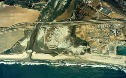
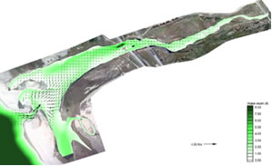
This project involved the hydrodynamic analysis using water levels, river flow data, and lagoon bathymetry to complete an estuary analysis for currents and water mixing within the Santa Margarita River Estuary using the Surface-Water Modeling System (SMS). This modeling simulation was conducted in support of a feasibility study for a constructed wastewater treatment wetland to assess the potential impacts of any discharge of treated water on the estuarine water quality. Fieldwork consisting of orthophotgraphy and topographic mapping, and bathymetric surveys was conducted to formulate the model’s base map for numerical simulations. The tidal-induced estuarine hydrodynamics including water level and currents were modeled with the consideration of the wetting and drying processes within the estuary boundary. The model calibration was performed using the water level data at the USGS gage located in the estuary. In addition, coastal processes within the shoreline segment of the estuary region were also assessed. The modeled results are to be used to determine potential accumulation of secondary contaminants from the wastewater discharge during times of no direct connection to the ocean.

